4:28 p.m. update
The tornado warning issued earlier by Environment Canada has ended.
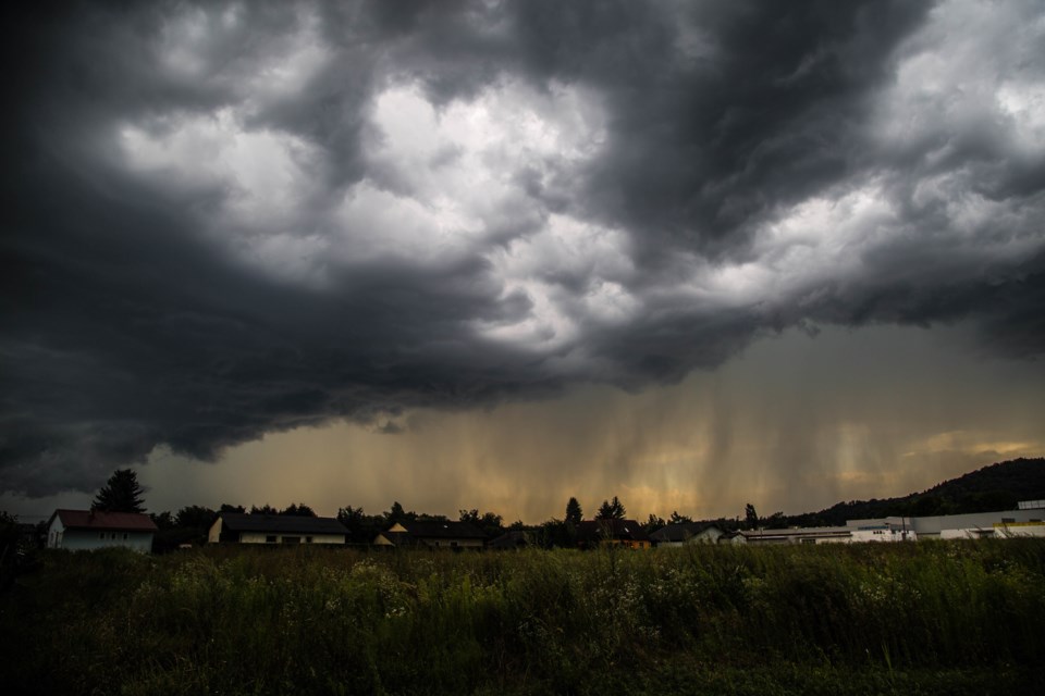
3:45 p.m. update
Shortly after issuing a severe thunderstorm warning for the area, Environment Canada has issued a tornado warning to replace it.
As of 3:41 p.m., meteorologists are tracking a severe thunderstorm that is possibly producing a tornado.
The updated warning warns of "damaging winds, large hail and locally intense rainfall are also possible."
Additional details from the warning follows:
A severe thunderstorm capable of producing a tornado is located 8 kilometres south of Abitibi, moving northeast at 50 km/h.
Hazard: Tornado and 90 km/h wind gusts.
Locations impacted include:
Abitibi, Dunning, Berylvale, Nahma, Florida and Brower.
This is a dangerous and potentially life-threatening situation.
Original release
Severe thunderstorm warning in effect for:
• Timmins - Cochrane - Iroquois Falls
At 3:25 p.m. EDT, Environment Canada meteorologists are tracking a severe thunderstorm capable of producing strong wind gusts and heavy rain.
This severe thunderstorm is located 8 kilometres northwest of Potter, moving northeast at 50 km/h.
Hazard: 90 km/h wind gusts.
Locations impacted include:
Abitibi, Potter, Dunning, Mistango Lake, Berylvale, Nahma, Florida, Brower, Arpin and Norembega.
Strong wind gusts can toss loose objects, damage weak buildings, break branches off trees and overturn large vehicles. Remember, severe thunderstorms can produce tornadoes.
Lightning kills and injures Canadians every year. Remember, when thunder roars, go indoors!
Emergency Management Ontario recommends that you take cover immediately if threatening weather approaches.
Severe thunderstorm warnings are issued when imminent or occurring thunderstorms are likely to produce or are producing one or more of the following: large hail, damaging winds, torrential rainfall.
Please continue to monitor alerts and forecasts issued by Environment Canada. To report severe weather, send an email to [email protected] or tweet reports using #ONStorm.
For more information, please click here.


