Crews continue to battle a wildfire south of Timmins and west of Temiskaming Shores.
Kirkland Lake 5 has been burning since Aug. 3 about 80 kilometres west of Latchford, five kilometres southeast of McKee Lake.
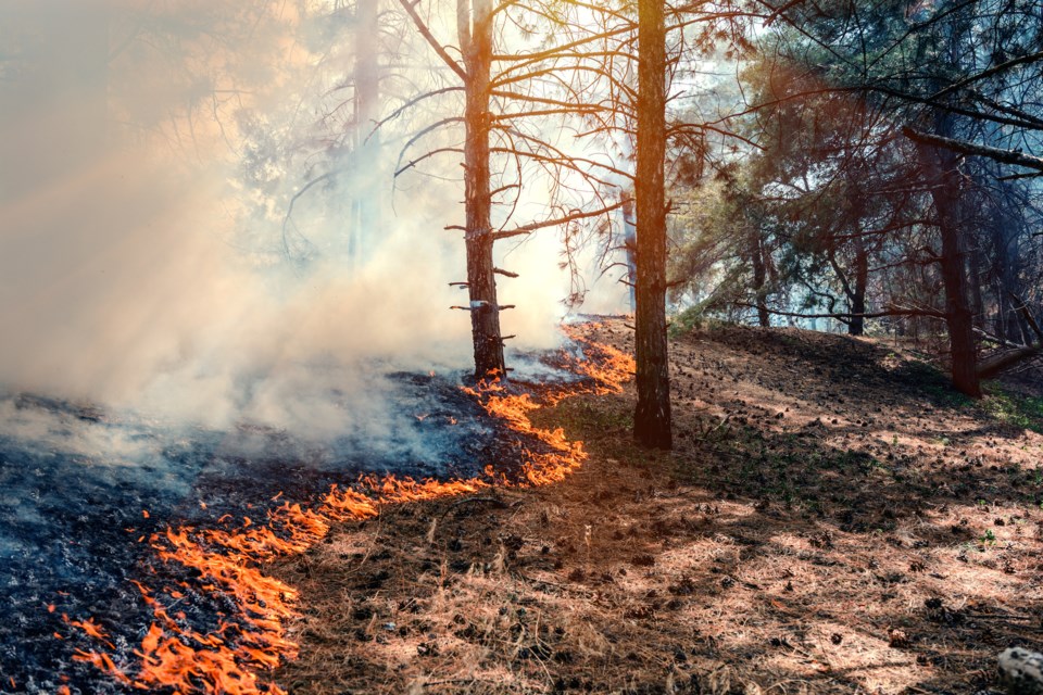
The 889 hectare blaze is not yet under control.
“Aerial fire suppression is being applied today using helicopters with buckets. In addition, 13 FireRanger crews, three fire management staff and five helicopters are assigned to this wildland fire,” said Aviation, Forest Fire and Emergency Services in its daily report.
There was also one new fire in the Northeast Region today.
Bancroft 3 was located on an island on Three Island Lake, three kilometres west of St. Nora Lake. It’s already out.
There are 20 other active wildfires in Ontario’s Northeast Region, one is under control and 19 are being observed.
“The fire hazard is mostly low to moderate in the southern portion of the Northeast Region and moderate to high for the rest of the Northeast Region with the exception of an area with extreme fire hazard in the far north at the Manitoba border,” the report added.
Find Tuesday's full news release below:
Aviation, Forest Fire and Emergency Services
Northeast Fire Region
August 13, 2024
Time of Report – 18:00
Northeast Region
There was one new wildland fire confirmed in the Northeast Region by early evening on Tuesday, August 13.
- Bancroft 3 (BAN003) is a 0.1 hectare fire located on an island on Three Island Lake, 3 kilometres west of St. Nora Lake. One crew of FireRangers have actioned this fire and it is now out.
At the time of this update, there are 21 active wildland fires in the Northeast Region. Of these, 1 is not yet under control, 1 is under control and 19 are being observed.
Fire of note
- Kirkland Lake 5 (KLK005) is located approximately 5 km north of Stull Lake, 5 km southeast of McKee Lake, and approximately 80 km west of Latchford. This fire is 889 hectares in size and is not under control at the time of this update. Aerial fire suppression is being applied today using helicopters with buckets. In addition, 13 FireRanger crews, 3 fire management staff and 5 helicopters are assigned to this wildland fire. An updated fire perimeter can be consulted on the province’s interactive map.
The fire hazard is mostly low to moderate in the southern portion of the Northeast Region and moderate to high for the rest of the Northeast Region with the exception of an area with extreme fire hazard in the far north at the Manitoba border.
For current wildland fire danger values check our interactive map.
No Drone Zone: Be safe, stay clear of forest fires!
Flying drones around forest fires is both dangerous and illegal. When you fly a drone near a forest fire, you can put the lives of pilots, firefighters and other emergency personnel at risk. Be safe, stay clear of forest fires.
Help fight forest fires: Stay clear of waterbombers!
When waterbombers approach a body of water, move close to the shore so they can perform their scoop safely. A waterbomber will not scoop from a lake or river if encroaching watercraft pose a safety hazard. Be safe, stay clear of waterbombers.
Report a Wildland Fire
To report a wildland fire located north of the French and Mattawa rivers, please dial 310-FIRE. To report a wildland fire located south of the French or Mattawa Rivers, please dial 9-1-1.
For tips on preventing wildland fires and information on the current fire situation, follow us on Facebook, Instagram and X (formerly Twitter) in English and French: @ONforestfires and @ONfeudeforet. For more information about the current wildland fire situation, visit www.ontario.ca/forestfire.


