Six new wildfires were confirmed in the Northeast Region by early evening on Wednesday, raising to 35 the number of active burns in the area, according to the Aviation, Forest Fire and Emergency Services daily news release.
None of the new fires are under control.
Chapleau 10 is 0.1 hectares located approximately 13 kilometres west of Foleyet and 1.6 kilometres north-northwest of Wakagami Lake. North Bay 12 is 0.2 hectares located on the south side of Diamond Lake, approximately 36 kilometres northwest of Temagami.
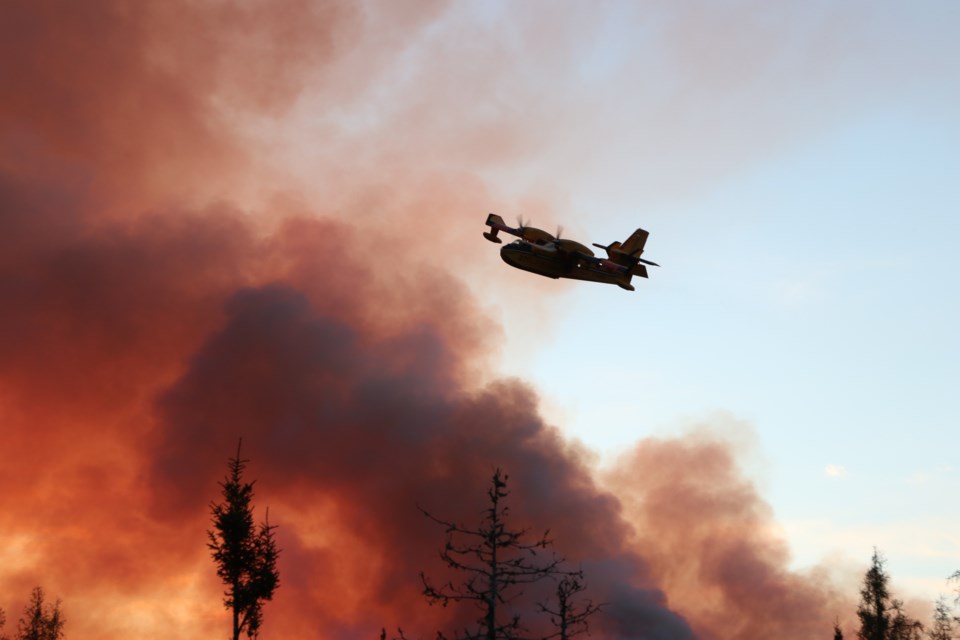
Wawa 13 is 0.4 hectares located approximately 13 kilometres east of Negwazu Lake and 18 kilometres north of Highway 519. This fire is receiving fire aerial support. Timmins 13 is two hectares located approximately 11 kilometres northwest of Kamiskotia Lake and 33.5 kilometres northwest of Timmins. This fire is receiving fire aerial support. Timmins 14 is 0.2 hectares about 9.5 kilometres west of Kamiskotia Lake and 30 kilometres north-northwest of Timmins. This fire is receiving fire aerial support.
Parry Sound 7 is 0.4 hectares located on the shore of Georgian Bay on Chicken Liver Channel, approximately 6.5 kilometres northwest of Georgian Inlet.
The fire hazard is generally high for much of the Northeast Fire Region. There are areas of moderate fire hazard from Lake Superior Provincial Park through to Kapuskasing, around Fort Albany, the eastern half of Manitoulin Island, and from Kirkland Lake south to Gravenhurst. Areas east of North Bay and the Highway 11 corridor are under a low fire hazard. In the Far North, the area around Peawanuck is under an extreme fire hazard.
Following is Wednesday's complete news release:
Aviation, Forest Fire and Emergency Services
Northeast Fire Region
August 21, 2024
Time of Report – 18:20
Northeast Region
There were six new wildland fires confirmed in the Northeast Region by early evening on Wednesday, August 21. At the time of this update, there are 35 active wildland fires in the Northeast Region: 8 are not under control, 2 are being held, 2 are under control and 23 are being observed.
- Chapleau 10 (CHA010) is a 0.1 hectare wildland fire that is not yet under control. This fire is located approximately 13 kilometres west of Foleyet and 1.6 kilometres north-northwest of Wakagami Lake.
- North Bay 12 (NOR012) is a 0.2 hectare wildland fire that is not yet under control. This fire is located on the south side of Diamond Lake, approximately 36 kilometres northwest of Temagami.
- Wawa 13 (WAW013) is a 0.4 hectare wildland fire that is not yet under control. This fire is located approximately 13 kilometres east of Negwazu Lake and 18 kilometres north of Highway 519. This fire is receiving fire aerial support.
- Timmins 13 (TIM013) is a 2 hectare wildland fire that is not yet under control. This fire is located approximately 11 kilometres northwest of Kamiskotia Lake and 33.5 kilometres northwest of Timmins. This fire is receiving fire aerial support.
- Timmins 14 (TIM014) is a 0.2 hectare wildland fire that is not yet under control. This fire is located approximately 9.5 kilometres west of Kamiskotia Lake and 30 kilometres north-northwest of Timmins. This fire is receiving fire aerial support.
- Parry Sound 7 (PAR007) is a 0.4 hectare wildland fire that is not yet under control. This fire is located on the shore of Georgian Bay on Chicken Liver Channel, approximately 6.5 kilometres northwest of Georgian Inlet.
Fire of note:
- Kirkland Lake 5 (KLK005) is located approximately 5 kilometres north of Stull Lake, 5 kilometres southeast of McKee Lake, and approximately 80 kilometres west of Latchford. This fire is 889 hectares in size and is not under control at the time of this update. FireRanger crews and helicopters with bucketing capabilities continue to work on this fire. Updated fire perimeter can be consulted on the province’s interactive map.
The fire hazard is generally high for much of the Northeast Fire Region. There are areas of moderate fire hazard from Lake Superior Provincial Park through to Kapuskasing, around Fort Albany, the eastern half of Manitoulin Island, and from Kirkland Lake south to Gravenhurst. Areas east of North Bay and the Highway 11 corridor are under a low fire hazard. In the Far North, the area around Peawanuck is under an extreme fire hazard.
For current wildland fire danger values check the interactive map.


